History
In 1948, County voters approved a ballot measure that made Montgomery the first county in Maryland to adopt a home rule charter, changing a county commissioner system that kept most of the power in Annapolis. The new charter established a Council-Manager form of government and, in 1949, six men and one woman were elected to the first County Council. In 1968, voters amended the charter to create the post of County Executive. The first County Executive was elected in 1970. In November 1986, voters amended the charter to increase the number of Council seats from 7 to 9, starting in 1990, with four members elected by all the County’s voters and five elected by geographic district.
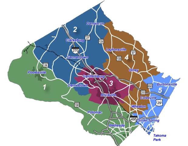
Geography
Council District boundaries were adopted by the Council in 2012 after the decennial Census. District 4 stretches up Georgia Ave. from Wheaton to the Howard County border. The southern part of the district includes Randolph Hills, Kensington Heights, Aspen Hill, Glenmont, Layhill Village and Colesville (west of MD 650). Moving north, the district includes Ashton, Sandy Spring and Olney. It also includes rural communities up-county, such as Sunshine, Etchison, Brookeville and Laytonsville. Most of the eastern boundary of District 4 is MD 650 (New Hampshire Ave.). The western boundary is MD 124 (Woodfield Rd.) until just south of Watkins Rd.
Learn More about Montgomery County’s Five Council Districts in the Planning Department’s Montgomery County Snapshot: Council Districts By the Numbers and Montgomery County Data Atlas: Council District Maps.
Find Your Council District
If you are unsure which council district you reside in, you can use the Montgomery Council Council “Find My Council District” website.
Montgomery County Council District Map